Main Menu
AORC Libraries
MEDMAPS
Dublin Core
Title
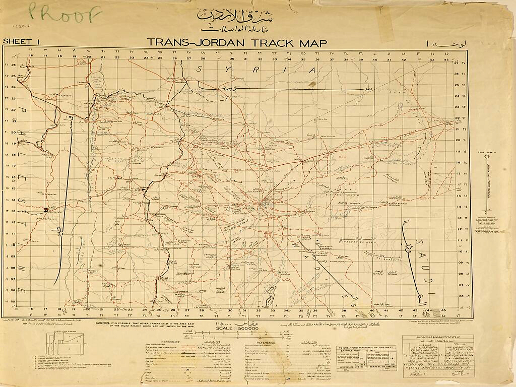
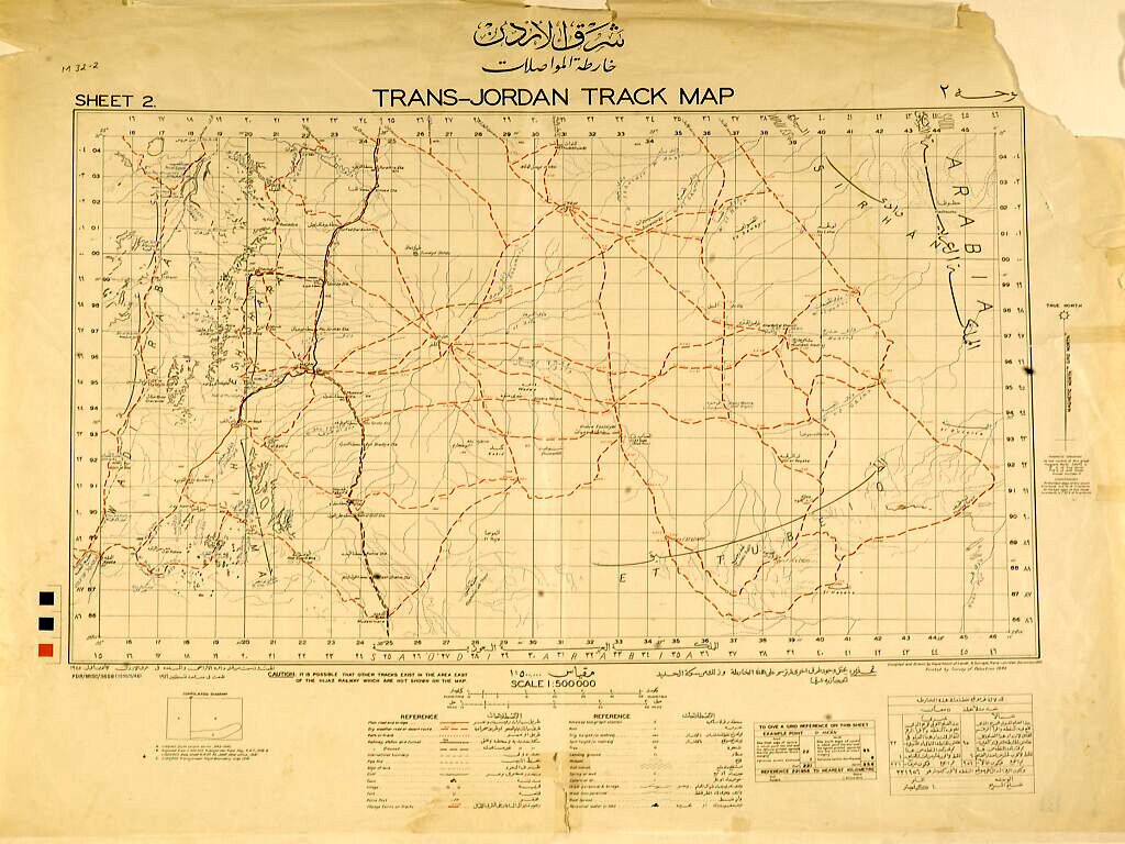
Trans-Jordan track map: Sharq Al-Urdun-kartt Muasalat
Description
Engraved map on 2 sheets.
43 x 65 cm. and 48.3 x 66 cm.
This is a very interesting and detailed map of Trans-Jordan (now the Hashemite Kingdom of Jordan), specifically depicting the footpaths and goat tracks in the region east of the Jordan river. It was printed by the Survey of Palestine, an institution which produced many maps of the Near East.
The Survey of Palestine as an arm of British colonial and military policy was established informally in about 1913, when Kitchener, then British Agent in Cairo, decided that the area west and north of the Egyptian border with Sinai needed to be surveyed for military purposes. This area was then under Ottoman rule and it was not possible to send out a survey party of British Army Royal Engineers, which would have been the normal practice. Kitchener, who had participated in the survey of western Palestine carried out by the Palestine Exploration Fund from 1872 to1877, decided that the new survey could be presented and carried out as an extension of the earlier surveys. The Palestine Exploration Fund cooperated with the new Survey of Palestine by sending an archaeologist out to examine any biblical remains in the survey area. From this beginning the Survey of Palestine developed into an extensive cartographic service which mapped every part of Palestine and other parts of the Near East. Note that 1920 is given as the founding date of the service in the official history of the Survey of Palestine. The Survey was operative until 1948, when it was subsumed into the Survey of Israel.
The Survey of Palestine as an arm of British colonial and military policy was established informally in about 1913, when Kitchener, then British Agent in Cairo, decided that the area west and north of the Egyptian border with Sinai needed to be surveyed for military purposes. This area was then under Ottoman rule and it was not possible to send out a survey party of British Army Royal Engineers, which would have been the normal practice. Kitchener, who had participated in the survey of western Palestine carried out by the Palestine Exploration Fund from 1872 to1877, decided that the new survey could be presented and carried out as an extension of the earlier surveys. The Palestine Exploration Fund cooperated with the new Survey of Palestine by sending an archaeologist out to examine any biblical remains in the survey area. From this beginning the Survey of Palestine developed into an extensive cartographic service which mapped every part of Palestine and other parts of the Near East. Note that 1920 is given as the founding date of the service in the official history of the Survey of Palestine. The Survey was operative until 1948, when it was subsumed into the Survey of Israel.
Publisher
Printed by the Survey of Palestine.
London: Trans-Jordan Department of Lands and Surveys, 1945-1946.
Date
1945-1946
Contributor
From the collection of the American Center of Oriental Research (Amman, Jordan), M.32.
Language
In English and Arabic.
Collection
Dublin Core XML
Citation
"Trans-Jordan track map: Sharq Al-Urdun-kartt Muasalat," online in Digital Library for International Research Archive, Item #15, http://www.dlir.org/archive/items/show/15 (accessed July 22, 2026).