Main Menu
AORC Libraries
MEDMAPS
Dublin Core
Title
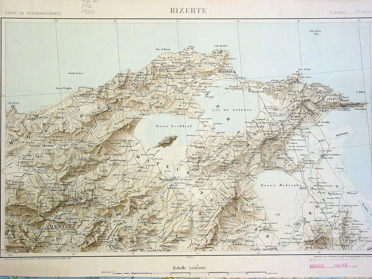
Bizerte
Description
Engraved map produced by the French Army Geographic Service.
31.5 x 49.5 cm.
Scale 1:200,000.
At the time this map was produced, Bizerta or Bizerte was the most important French naval port in the Mediterranean after Toulon. The port is located at the point where the Lake of Bizerta enters the Mediterranean. Its commanding strategic position, east of Cape Blanc, on the narrowest part of the Mediterranean sea, was one of the reasons for the occupation of Tunisia by the French in 1881. The map is in fact based on surveys undertaken by the Geographic Service of the French Army between 1881 and 1897. The whole map is on at least seven sheets, some of which were revised in 1930.
Source
Carte de Reconnaissance Tunisie, Feuille II.
Publisher
Paris: French Army Geographic Service, ca. 1920-1930.
Date
1920-1930
Contributor
From the collection of the Centre d'Études Maghrébines à Tunis (Tunisia) 916.611.Fra 1920.
Collection
Dublin Core XML
Citation
"Bizerte," online in Digital Library for International Research Archive, Item #11, http://www.dlir.org/archive/items/show/11 (accessed July 22, 2026).