Main Menu
AORC Libraries
MEDMAPS
Dublin Core
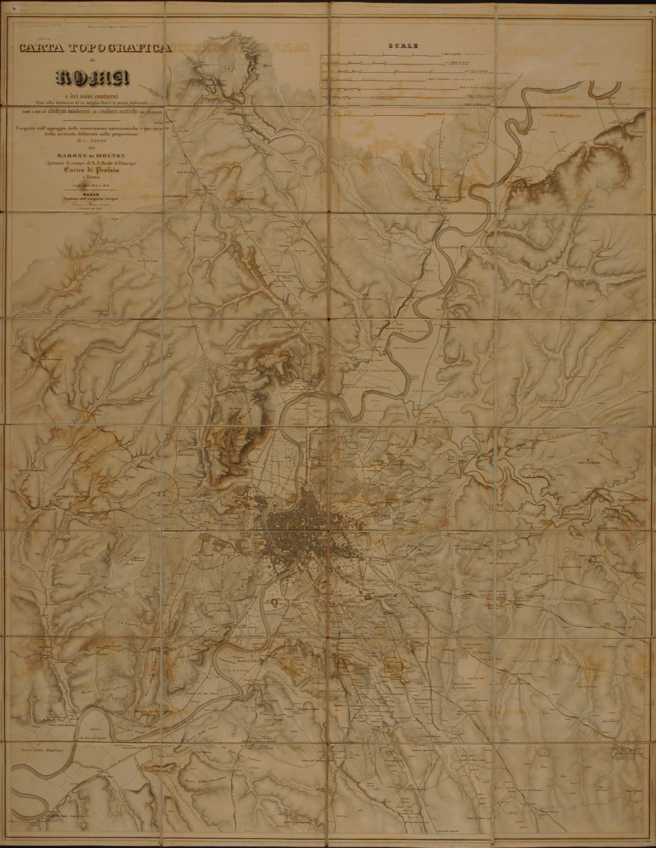
Title
Carta topografica di Roma e dei suoi contorni fino alla distanza di 10 miglia fuori le mura.
Description
Engraved map by Helmuth von Moltke.
102 x 80 cm.
Scale 1:25,000.
Helmuth Carl Bernhard Moltke is an unusual figure in the history of cartography, despite the fact that the military cartographer is a common figure. Above all, he was a remarkable professional soldier, the greatest strategist of the latter half of the 19th century, and chief of staff of the Prussian Army for thirty years. He was regarded as a brilliant student, and one of his chief occupations as a young officer was surveying and mapping, although his tastes inclined him to literature, to historical study and to travel. The most important of his early travels was a sojourn in southeastern Europe for six months in 1835 that resulted in an offer from Sultan Mahmoud to join the Turkish Army. Moltke was given leave by Berlin, and he remained in the Turkish service for three years, learning Turkish, surveying Constantinople, the Bosphorus and the Dardanelles for the Sultan, and travelling through Bulgaria and Rumelia in the imperial retinue. In 1838 he was sent as an adviser to the Turkish general commanding the troops in Armenia. During the summer he made reconnaissances and surveys, riding several thousand miles in the course of these journeys; he navigated the Euphrates and mapped many districts where no European traveller had preceded him since Xenophon. Following the failure of the Turkish campaign against Mehmet Ali of Egypt, he returned to Germany in 1839 after many hardships. In December 1845, Moltke was named personal adjutant to Prince Henry of Prussia in Rome. His duties were light and allowed him time to study the land and people of Rome and its environs. He complained that a really accurate map of Rome and its vicinity was lacking, so he spent his leisure in a survey of Rome and the Campagna. The result is this splendid map of Rome. The map is usually found in two sheets, as it was printed, but copies are known in which the sheets have been joined together, as in the American Academy in Rome copy.
Bibliography:
Fritz Mutschke. Moltke als Geograph. Freiburg im Breisgau, 1935.
Bibliography:
Fritz Mutschke. Moltke als Geograph. Freiburg im Breisgau, 1935.
Publisher
Berlin: Shropp, 1852.
Date
1852
Contributor
Engraved by Enrico Brose.
From the collection of the American Academy in Rome, RBR 052.2 Rom M.
Collection
Dublin Core XML
Citation
"Carta topografica di Roma e dei suoi contorni fino alla distanza di 10 miglia fuori le mura.," online in Digital Library for International Research Archive, Item #8, http://www.dlir.org/archive/items/show/8 (accessed July 22, 2026).